|
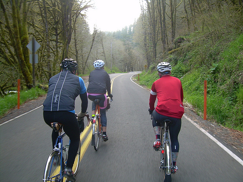
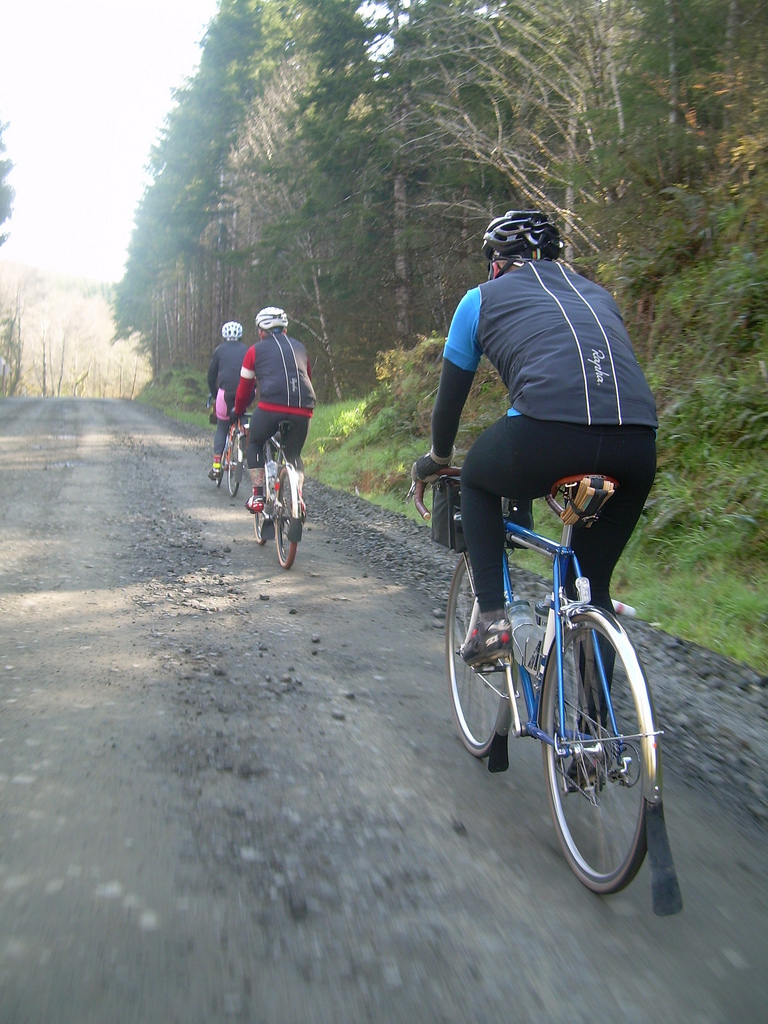
Riders: Robert Higdon, Christopher Gay, Dylan Carney, Joshua Bryant
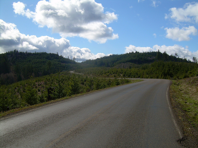
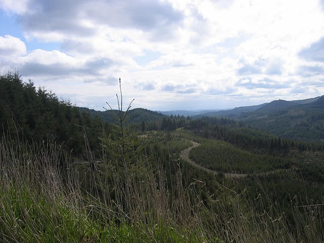
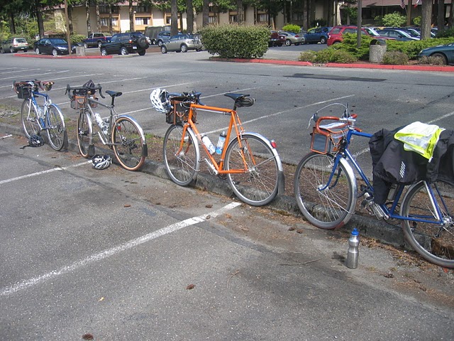
The plan was simple: In keeping with the historic origins of the flèche, we had designed a course that utilized as many scenic backroads as possible while covering a distance that would challenge our team’s cycling abilities yet still allow us to enjoy the beautiful Pacific Northwest countryside that our multi-state route would take us through on our way to Olympia, Washington. Our course ended up being nearly perfect for the task, with just under 3,000 meters of climbing over 431 kilometers, 2 states, 1 ocean, 25 kilometers of unpaved roads, and no sleep stops. Dylan Carney, Chris Gay, Robert Higdon and Joshua Bryant teamed up and started the ride on a sunny Friday afternoon in Hillsboro, Oregon, after a short light-rail ride out of Portland to avoid the city’s western sprawl. Upon taking care of our brevet cards, we quickly made our way to Forest Grove, and then south to Carlton along familiar farm roads. We made comfortable time while enjoying the sunshine, which was a bit of a shock considering the forecast called for rain. The rains would come soon enough, though. We made a brief stop to re-supply in Carlton and to get our cards signed. This first control also marked the beginning of Robert being heckled by locals (this was an ongoing theme during our ride). Robert decided to wear his Team Soft Like Kitten cyclocross kit, adorned in pink and grey. Apparently, pink really challenges the way people in the NW countryside view your sensibilities, as I'm sure it does in other parts of the country. Article 6 in the RUSA Rules for Riders says something to the effect of dressing in accordance with respect for local decorum. We sincerely had no idea pink would be so offensive. We quickly made our way out of Carlton, eventually climbing Nestucca River Road. This gem of a road was new to most of our group, and will certainly be remembered as a road worth planning future rides around. The road climbed up to just under 600 meters, with some gentle rollers and a few stiff sections for good measure. As soon as we crested the clear-cut summit, we entered the wetter, western side of the Coast Range, where the abundance of moss, fallen trees, and a rushing river made it seem that trolls, unicorns, andsasquatch weren't too far away. Although we failed to spot any of these magical creatures we happened to startle a gang of elk that were grazing by the road. They took flight while we rode along and we watched as their silhouettes threaded between the shadowed trees and finally disappeared up a hill and deeper into the forest. Nestucca River Road meanders for about 70km along it’s namesake river, winding its way slowly toward the Pacific Ocean. With its gentle twists and turns, a short, smooth, unpaved section, and nearly nonexistent traffic we were able to keep a rapid pace towards our next control in Tillamook. It was a wonderful alternative to our usual route to Tillamook over Highway 6, which pits us against traffic that is unpredictable in volume. We reached the turnoff to the much busier highway 101 directing us towards our next control, but luckily, everyone seemed to be leaving Tillamook, not heading towards it. Robert’s mother’s house, just off the highway south of town, was a rewarding stop, where we were welcomed with the bowls of coffee, grilled cheese sandwiches, chips, and granola bars she had set out after Robert called her and said we’d be stopping by for a quick hello. Our afternoon start time made it so that we were leaving her house around sundown, making the final kilometers into downtown Tillamook in the twilight. We stopped at a gas station to get our cards signed and to stock up for the evening as our next stop, Astoria, wouldn't be reached until after 2am, with nary a resource along the way. Before leaving Tillamook, we encountered the first rains of the night. Typically there is a bit of "rain warning" here in the NW, consisting of a gentle rain, followed by a harder shower. However, being so close to the ocean, we didn't get the gentle warning, just the deluge. As the rain was coming down and we were pulling out of Tillamook, cars and trucks were entering the city. Our taillights and the autos headlights combined with our rain spattered glasses to send fractured shards of red and white light across our vision making the road nearly impossible to see. These first kilometers out of town could not have passed quickly enough. Luckily, we had only 13 kilometers to go along Highway 101 before turning off onto the much quieter Miami Foley Road. A new found favorite, Miami Foley Road has a nice, very slightly undulating rhythm going north-bound that makes it easy to keep a quick pace. It also helped that the rain fell much softer along this stretch of roadway being sheltered by a range. The splash of these gentler raindrops had a bit of a horror-film feel to them, with our Edelux and E3 headlamps reflecting off the concentric splashes as they hit the lightly steaming pavement. This stretch went by much too quickly and we soon found ourselves back on 101, though there was very little traffic now as most don't travel around the coast well after dark. We tackled our first "wake-up" hill and immediately the rain gods decided to test our endurance to the cold and the elements. Shortly after cresting the climb, the skies opened up and let loose a fury of rain. It would soften as we reached the bottom, as though it were enticing us, testing us to make our way up the next climb, only to open up again as we reached the top. It was a long, cold section for us all. Even though Joshua recalled the climbs being longer on last years’ flèche, this section seemed to carry on a while. After descending the second rain-soaked summit, Chris got a flat, our only one of the trip. The skies had cleared temporarily, and fortuitously, we happened to be in front of an illuminated driveway, which was the only light anywhere near us. We teamed up to make the repair as quickly as possible, as our teeth were beginning to chatter from being stopped in the cold night air. Some of us found our bikes shimmying on the following descents, as our bodies shivered with cold. We clamped our top tubes between our legs to stabilize our bikes on the descents, and spun quickly up the ascents to bring warmth back into our limbs and extremities. Coming into Seaside, OR, in keeping with the theme, the slight descent from the junction with hwy 26 found us in another downpour as we anxiously anticipated our turn-off. We finally found it, much later than expected. We didn’t know it, but that was the last of the rain we’d see during the night. The turnoff onto Lewis and Clark rd. was most welcome, and even though there hadn't been much traffic along highway 101 in the middle of the night, it was completely nonexistent now. We found our way into Astoria, in the extreme Northwest corner of Oregon, the fatigue of being wet and cold much of the last 100 kilometers having now caught up to us. We were all in need of a sock change, coffee, and calories, so we found the only open business. Unfortunately, Astoria's youth seemed to find this particular gas station their after-hours hang out. Many youngsters in altered states were milling about, not really hanging out with one another, more just taking up space next to one another. We rested at bar-stools in the cafe of the gas station, finding nourishment among the aisles of chips and candy and stoking our engines with much needed hot coffee. Astoria marked a symbolic (if not geographic) halfway point for our trip, as this is where we crossed up and over the mouth of the Columbia River on the majestic Astoria-Megler Bridge into Washington. Crossing the bridge is quite stunning in a car in the daytime, to say nothing of crossing it on a bicycle, at night. The bridge is the longest continuous truss bridge in North America, spanning more than 6 kilometers over the mouth of the Columbia. We traversed it in silent awe, the dark glint of the water below barely visible in the night and the occasional call of gulls the only indication that there was life below. Up until leaving Astoria we were a bit ahead of schedule, and we knew if we kept our pace up, time would not be a problem. We made our way into the dropping temperatures, taking a more direct route towards Raymond, WA than the meandering Highway 101. Despite the caffeine infusion in Astoria, it was along this stretch that we found ourselves fighting off the sleep that we’d been depriving our bodies of. As the last few hours of night retreated from the morning we worked on keeping our gazes to the horizon and not inches from our front wheels where our eyes struggled to rest before closing. Our pace was slower than it should have been and we welcomed the sight of the morning sun just as we were were nearing the Willapa Bay. In one of the sloughs, we spotted another large gang of elk, the excitement helping wake us up and spark conversation that had disappeared with the night. We got into Raymond about an hour after we’d planned, and in spite of our delayed arrival, we spent time in the local McDonalds, ate breakfast, and consumed more coffee, as ahead of us lay 60 kilometers of challenging climbs, about 20 of which were gravel, with the climbing slated to begin immediately upon departing town.
The gravel sections into and out of Brooklyn are typically some of the least used roads in the area, but we crested the first loose gravel climb to find a group of people hanging out watching the road. They were just milling about drinking, as if waiting for us, which struck us all as very odd. Dylan rang his bike bell and they let out a good laugh. We had noticed a sign that warned of a road closure and along the way there were a few small signs with florescent pink exclamation points near sharp turns on the freshly graveled road. The clues were starting to slide into focus and we soon realized that we would be sharing the steep ascents and winding turns of the descents with rally cars looking to familiarize themselves with the road. Shortly after passing through Brooklyn the traffic started. Racers and spectators alike passed alongside us in cars and massive trucks, giving us a nice cloud of dust to breathe in as we made our way farther up into the Willapa Hills.
There were more and more people hanging out by the side of the road watching us as we ascended. Most were in a drunken state of disbelief that we were there and were quite boisterous about what they thought of us. When a woman in a Subaru rally car rolled up and let us know that there was going to be a race coming through here, we nodded our heads. We had figured that out already. It was roughly 10:00 am by this point. The race wasn’t starting until 1:00 pm. No problem right? Apparently racers really love testing a course out ahead of time. We fought off drivers doing semi-hot laps (taking all of the good lines and throwing us off ours) and got heckled throughout the entire section. While this bit seemed to take forever, we actually made up some time on our overall schedule, our climbing made quicker by the fact that we wanted to get beyond these disapproving spectators. We left the gravel and that’s when Joshua’s smallest freewheel cog broke. He managed to cobble enough of it together to keep going, albeit using only the 3 largest cogs on his freewheel. The added challenge seemed to invigorate him though, and his riding was as strong as ever for the remainder of the ride. We quickly reached our 22 hour mark and made a note of where we were, about 10 kilometers from where we had planned to be, just outside of Oakville, WA. We checked into our planned stop to grab a few necessities and found the organizers there waiting for us. We made our stop brief, filling them in on the conditions of the section we had just passed and we found out that several other teams were making their way through there at later points in the day. From here we headed towards Olympia, passing through Capitol State Forest along pleasant, low volume roads. With the final destination within our reach, we tried valiantly to make it the entire planned course within the allotted time, digging deep and trying to keep each other motivated. Along this stretch an incredibly brief round of hail came and went within moments, providing a bit of variety in the now warm weather. Of course, it coincided with a descent and it bounced off the road and our clothing and stung as it struck our faces. As our 24 hour mark came, we had arrived at an intersection roughly 424 km from the start. We high-fived and congratulated each other. This means we came within 1.6% of our planned distance of 431 km, not bad for a 24-hour ride. We rolled into the final control shortly after 2:00pm on Saturday, 24 and a half hours after we’d begun our trip back in Oregon. We grabbed a cold beer from the volunteers, sat on the pavement, and began to nag incoming randonneurs with our tales.
|
|
|
|